

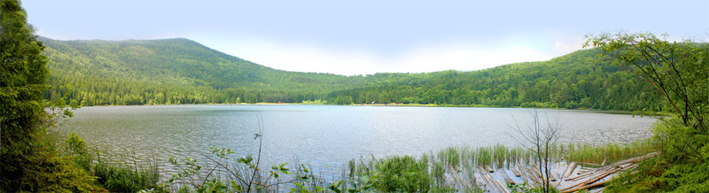
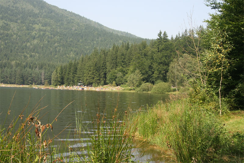
Lake Saint Anne is one of the most attracting sights in the Szeklerland. It is located in one of the twin craters formed at the summit of Mount Csomát - a volcanic cone at the southern extremity of the Hargita volcanic mountain range (the other crater hosts the Mohos peat bog). The lake is situated in the only intact volcanic crater in East-Central Europe. Its surface is about 949-950 m above sea level. The lake is part of the Mohos Nature Reserve.
Getting there
Lake Saint Anne is situated 55 km from Csíkszereda and 48 km from Sepsiszentgyörgy. Driving along national road 12, which links Csíkszereda with Sepsiszentgyörgy, one has to follow the road signs, and take route 113 at Sepsibükszád. Setting out from Kézdivásárhely, it is a 33-km-long journey along route 113. The lake can be reached on foot, as well, following the red cross hiking trail, the head of which is in Tusnádfürdő. It is a 4.5-km-long walk, and takes about 1.5 hours to complete. If you want to approach the lake along a hiking trail from Lázárfalva, follow the red cross trail, then the blue cross trail. It is a 10-km-long walk to the Mohos peat bog. Lake Saint Anne lays at a 2-km-distance from the bog. The whole walk takes about 3 hours.
Description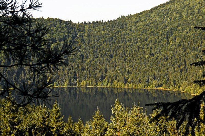 Mount Csomád is located in the volcanic arc of the Eastern Carpathians, which formed during the Tertiary Period as a result of an intense volcanic activity at the eastern edge of the Transylvanian Plateau. It is a massive volcanic cone with two craters. According to the latest international studies, the last eruption took place 10,600 years ago. Other researchers hypothesize that the last eruption happened 35,000 years ago. Attila Plibáth and Zoltán Pál, basing on some unpublished researches, hold that 30,000-year-old mud samples have been collected from the bottom of the lake, which leads to the conclusion that the lake is definitely older than 30,000 years.
The formation of Lake Saint Anne The lake has undergone several changes during the past 10,000 years. Recent research has identified several distinct phases in the formation of the lake. According to Zoltán Pál and Attila Plibáth's study on Lake Saint Anne, 9800 years ago the crater displayed the characteristics of a shallow lacustrine peat bog system, which, approximately 8800 years ago, was replaced by a raised bog complex with bog lakes. About 7050 years ago it formed into a shallow, mesotrophic lake, then into a lake with continuously raising water level. The water level kept fluctuating up until 2700 years ago. Later, until about 700 years ago, it was characterised by deep lacustrine oligotrophic conditions, and the depth of the lake was over 12 m. "The first signs of erosion caused by anthropogenic deforestation are estimated to date back to 1000-900 years ago" – argue Zoltán Pál and Attila Plibáth in their study. "The past 700 years can be characterised by a continuum of traces indicating human activity. The start of anthropogenic eutrophication as well as the gradual decrease of water level date back to 700 years ago. It was also then when a shallow floating bog formed on the northeastern shore of the lake. The quick and lasting changes in the vegetation of the lake are indisputable signs of anthropic influence."
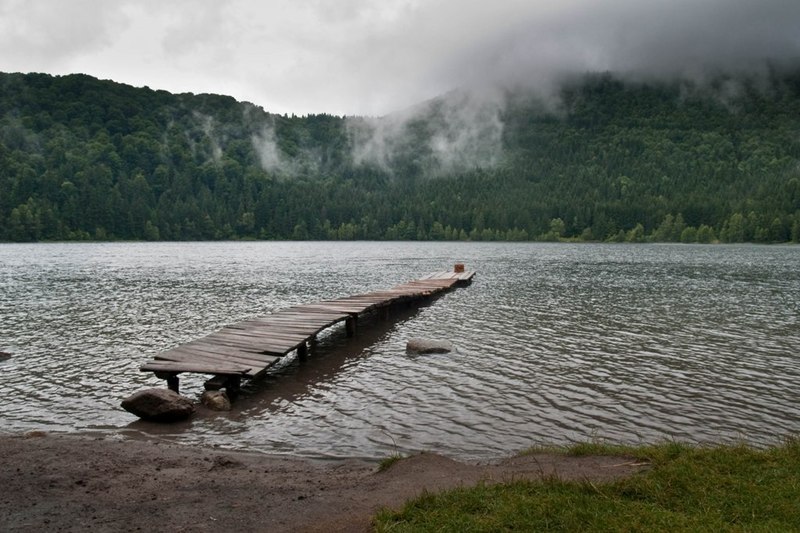
Lake Saint Anne and its crater
Unlike other crater-lakes, the basins of which are characteristically funnel-shaped, owing to the rapid infilling of Lake Saint Anne, large areas of its bottom slope gently. Infilling has also triggered a considerable decrease in the average and the maximum depth, the surface area and the shore length of the lake.
Surface area
The shape of the lake resembles a palette. The first reliable data on the surface area of the lake were provided by József Gelei, a professor at the Geographic Institute of Kolozsvár University, who measured 21.3 ha in 1909. Ninety years later, students specialising in geography at Babeş-Bolyai University, Kolozsvár, measured 19.3 ha. In all probability, the decrease of the lake's surface area is due to the fall of water level.
Shore length
In the middle of the 19th century the edge of the lake probably reached as far as the path running around the lake. The shore was 1749 m long in 1909, while only 1617 m was measured in 1999.
Water level
According to Attila Plibáth and Zoltán Pál's study, the surface elevation of the lake is 949-950 m above sea level. The elevation difference between the surface of the lake and the edge of the crater ranges between 120-135 m. The quantity of water stocked in the basin was estimated to be 86,500 m3 on 1909, having decreased to 68,500 m3 during the past ninety years.
Maximum depth
The first known measurement of the lake's depth was taken by Balázs Orbán, who dipped a 12.5 m long log from the ice into the lake (the most accurate measurement can be taken from the ice covering the lake). He measured 12.5 m, but the lake may have been even deeper. The first professional measurements were carried out by József Gelei. According to his findings, the maximum depth of the lake was 8.3 m in 1909. In our days specialists claim that the maximum depth of the lake is around 6-6.3 m. Fluctuations are due to intense ice- and snow thawing, as a result of which water level can increase by 60-70 cm. In the year 2000, using ultrasonic equipment, Zoltán Pál and his colleagues succeeded in drawing the mud-thickness map of the lake-bottom, highlighting on the fact that the thickness of the mud-layer can reach more than 4 metres on the deepest areas of the lake.
The ice sheet
The lake does not have other sources of inflow than precipitation and water infiltrating from the edge of the crater. This is why in 1909 the water of the lake was claimed to have a mineral content lower than that of distilled water, and it would also freeze over quite easily. The latter phenomenon can be observed even in our days. The ice-sheet that covers the lake in winter is also unusually thick, on average more than 70 cm, according to the measurements taken by Zoltán Pál and his colleagues in 1999, and it can occasionally reach even 1 m.
The quality of the water
 A century ago the mineral content of the lake was lower than that of distilled water. Recent water sample analyses revealed the existence of organic matter, sun-tan lotion and ammonia, especially during and after the bathing season. Mud sample analyses have proved that pollutants such as lead have been accumulated on the bottom of the lake, the source of which is, beyond doubt, the exhaust gases from cars that are allowed into the crater.
Flora and fauna
The specialist literature describes the lake as a proper habitat for the grass snake (Tropidonotus natrix). Newts (Triton montadoni) and frogs can be found in the lake only during their mating period. The Northern Pintail (Anas acuta) prefers the shrubby areas on floating peat mats. In 1908 and in the 1940s the brown bullhead was introduced in the lake. Despite a decline in the number of individuals, the species has not disappeared. Its existence is proved by an increasing number of sightings. Arthropods are represented by several species of backswimmers (Notonecta Glauca, Carixa), odonata (Erythromma najas, Libellula depressa, Leptetrum maculatum), snails, slugs as well as unicellular organisms.
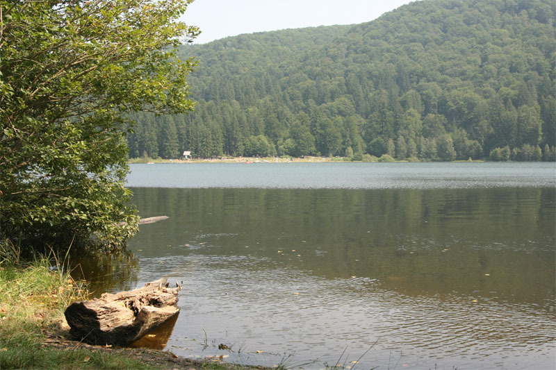
The inside of the crater is characterised by vegetation inversion. Spruce forests spread by the shore of the lake; while beech forests mixed with hornbeam grow on higher altitudes, covering the eastern and southern slopes. The vegetation inversion is due to the cool, humid microclimate of the crater.
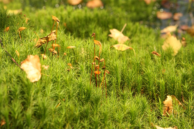
Apart from several species of peat moss and rare sedges, plants like the round-leaved sundew also occur in the bog situated northeast to the lake. The margin of the lake is covered by peat moss.
The Mohos peat bog
The Mohos peat bog is situated in the northern crater of Mount Csomád (the southern one hosting Lake Saint Anne), at the southern extremity of the Hargita volcanic mountain range. At 1050 m above sea level, the peat bog is one of the most important botanic nature reserves in Romania. It is part of the Mohos Nature reserve.
Getting there
The peat bog can be reached by car heading along the road that leads to Lake Saint Anne, leaving the car in the same car park. The peat bog can only be visited by guided groups.
Description:
 The results of recent research show that the Mohos crater was formed by the pyroclastic material ejected by an explosive volcanic eruption. The infilling of the crater was enhanced by the relatively quick denudation of pyroclastic deposits, as well as by the erosive activity of River Veres, which has its source inside the crater. The crater lake gradually turned into a nutrient-poor mountain bog soaked with cold, acidic water (pH: 3.8-4.1).
The peat bog is more than 10 m deep, with a peat-thickness amounting to 3 million m3, spreading on an area of 80 ha, a unique natural treasure in Europe. It has roughly a pentagonal shape, with a maximum length of 1000 m and a maximum width of 800 m. As its only source of inflow is precipitation, its water supply greatly depends on the season and on the quantity of precipitation received. The Hungarian novelist Mór Jókai claimed to have seen about 200-300 ponds of different sizes in this area in the middle of the 19th century. Although such data might be exaggerated, the number of ponds has considerably diminished in the course of the years. Gyula Istvánffy counted 29 bog lakes in 1894, while Emil Pop found only 13 in 1960.
The establishment of the nature reserve
In 1908 the Lázárfalva Compossessorate built a drainage system "so that the huge quantity of peat could be exploited and the soil should not give way when cattle are grazing". The drainage and the subsequent deforestation caused a significant decrease in the level of the bog. Basing on the data provided by István Urák and his colleagues, the first proposal aiming to establish a nature reserve on a 240-ha-area was handed in on 18 December 1975, and the nature reserve was established in December 1980.
 |
 |
 |
Vegetation and fauna
The Mohos peat bog is famous for its ice-age relict plants. Moreover, complex zoological surveys have proved that the area is interesting not only from a botanic, but also from a zoological point of view, being the habitat of a number of rare arthropods.
The first biologist who, in the 1950s, drew a list of the plant and animal species of the area was professor Emil Pop. Since then, other species have also been added to the list.
The Mohos can be regarded as a bog woodland with mossy areas. The peat – basing on its physical, chemical and botanical features – can be categorised as a moss-bog peat, being the habitat of different moss species. Its vegetation contains ice-age relicts such as different species of sundew (Drosera rotundifolia, Drosera obovata), the bog rosemary (Andromeda polifolia), the pod grass (Scheuchzeria plaustris), the hare's tail cottongrass (Eriophorum vaginatum), the black crowberry (Empetrum nigrum) or the cranberry (Vaccinium oxycoccus). The species structure of the vegetation is characterised by a low number of species and a high number of individuals.
|
|
|
The dominant plant of the ecosystem is the sphagnum, which forms sphagnum mat with cottongrass. Researchers have also identified 108 spider species representing 21 families. István Urák and his colleagues carried out research in the Mohos between 2003-2005, providing the first Romanian record of three species of spiders (Cnephalocotes obscurus, Maro minutus, Taranucnus setosus). Also, they proved the existence of three further species the occurrence of which had been questioned by specialists (Zelotes clivicola, Scotina palliardi), and identified two rare species of spiders (Notioscopus sarcinatus, Gnaphosa nigerrima). The findings of their research led to the conclusion that the dominant spider species in the peat bog is the Pirata hygophilius, also known as wolf spider, whereas in the beech forest the dominant spider species is the Coelotes inermis.
The unique vegetation and fauna of the bog used to be endangered by seasonal grazing, uncontrolled tourism as well as by forest fruit picking. Having recognised the problem, the Csík Association for Tourism and Nature Conservation took firm steps to save the Mohos. As a result of a successful tender, with the support of the Environmental Partnership Foundation, in the year 2000 the Association built a hanging walkway bridge over the peat bog.
Researchers are on the opinion that the successful conservation of this unique habitat largely depends on whether the backwards erosion at the source of the river Veres can be stopped. Several proposals have also been made on how to stop the infilling of Lake Saint Anne, which, hopefully, will be put into practice before long.
The area where the Mohos peat bog and Lake Saint Anne are located belongs to the Lázárfalva Compossessorate, the members of which are increasingly aware of the natural treasure hidden in that area, and pay particular attention to its conservation and protection.Fake Omega